The full record
Bronagh English, 18 — and how she came to leave a public road at Killardry Bridge
This is the whole record in one place, in plain language, from the council’s own documents and the family’s own dated photographs: who Bronagh was, the night she died, everything the records show about the road and bridge that failed her, and the law and standards that were meant to prevent it. Nothing here is invented; every figure and quotation is tied to a source. Where a judgement is the family’s, it is said to be theirs.
Who Bronagh was
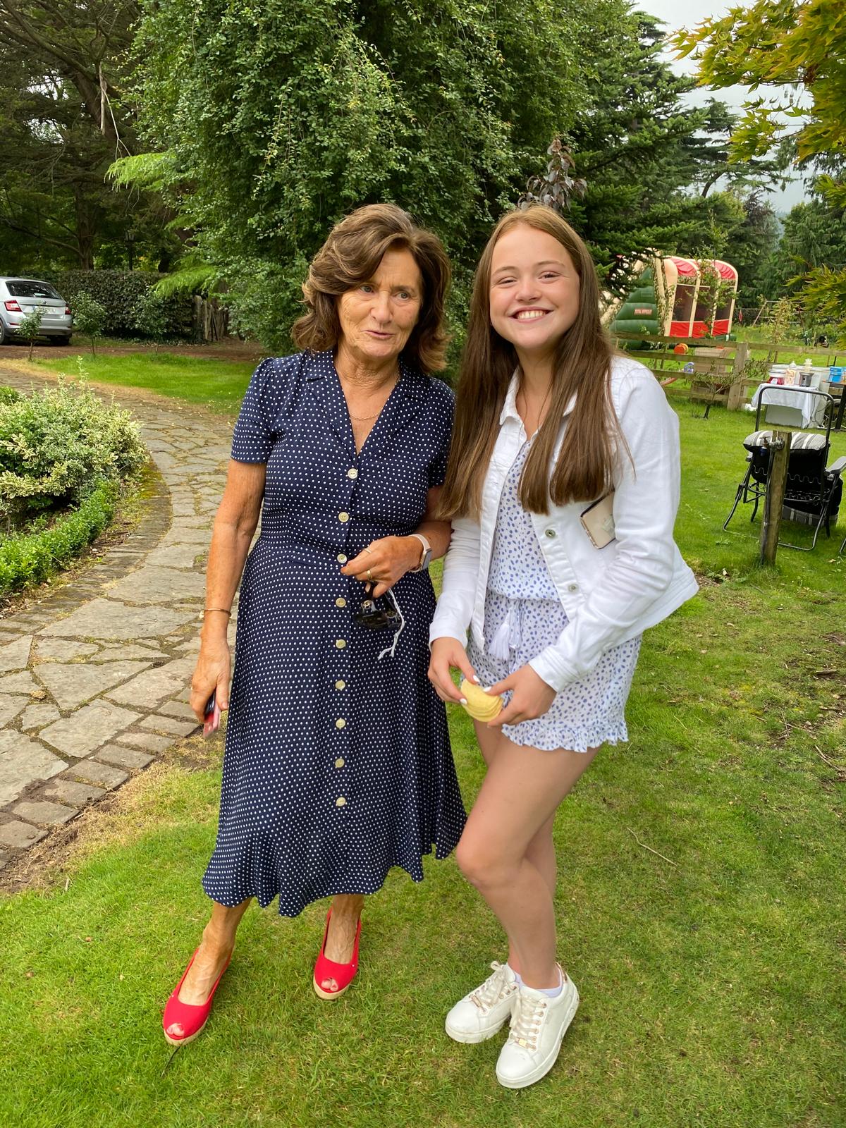
Bronagh English was an eighteen-year-old Leaving Certificate student from County Tipperary — a daughter, a sister, a friend, and a ladies’ footballer with Moyle Rovers. Her family remember her warmth and her smile. This record exists because of her, and begins with her.


The night
It was the night of 24 April 2025, about 22:01. It was dark — there is no lighting on that road — and it had been raining heavily. Bronagh was driving within the posted limit of 60 km/h (cut from 80 only eleven weeks earlier). The Garda review of the camera footage found she was within the limit and did not swerve. Her family’s forensic engineers put the maximum safe speed for that bend in the wet at 46 km/h. She met a blind bend and a bridge she was given no warning of, and a wall that could not hold her car.
The bridge, and the wall
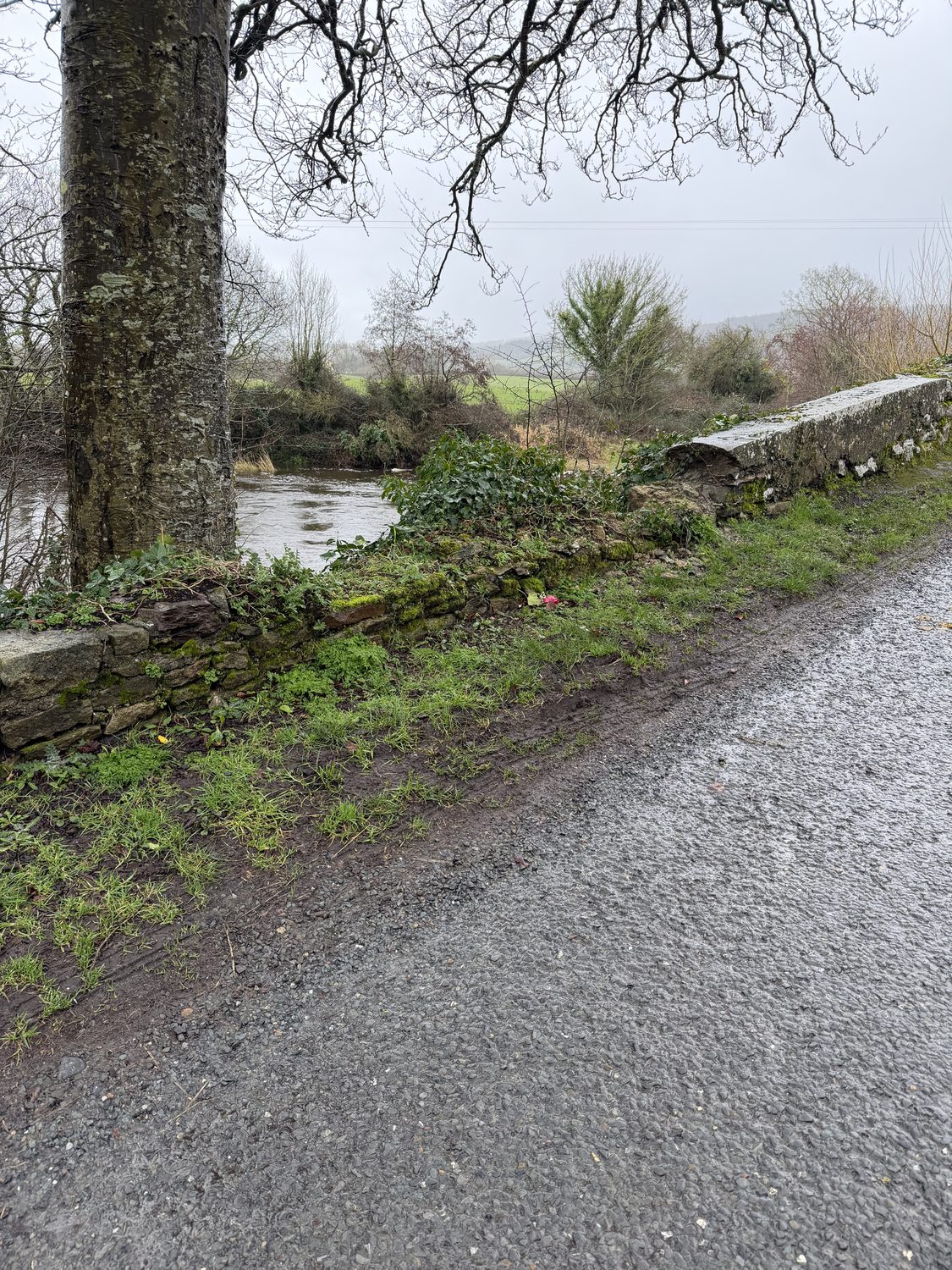
Killardry Bridge is an 1800s humpback stone bridge on the L3101, over the River Aherlow at Kilmoyler. A parapet — the wall along a bridge — is what keeps a vehicle on the road. Where Bronagh’s car left the road, that wall stood at about 0.23 metres. A barrier on a road structure should stand at about 1.25 metres. Beyond it was a drop of about 4.3 metres to the water, and no vehicle restraint of any kind.
What the council knew — from its own engineers
This was not information the council lacked. Its own engineers inspected this bridge and recorded its condition, at the council’s own expense.
20 June 2024 — “Warning.” A council maintenance inspection rated the bridge “Warning” overall. No repair followed.
21 January 2025 — “Significant Damage” (93 days before). A consulting engineer inspecting for the council recorded a five-metre length of parapet collapsed, stonework missing, the capping “partly removed,” a major abutment crack — and, in the record’s own words, “Is Signage Present? No.” The council paid €19,518.50 for this inspection. Then, for the 93 days until Bronagh died, the record shows no repair, no sign, no barrier, no closure.
TCC maintenance inspection 20 June 2024 and engineering inspection 21 January 2025, bridge record TY-L3151-B-010 — quoted verbatim. The inspection records →
What was — and was not — done on the ground
The family asked the council, under Freedom of Information, for the records of works on this road. What the council said, and what the dated records show, do not agree. This is set out in full below.
The council’s account, against the record
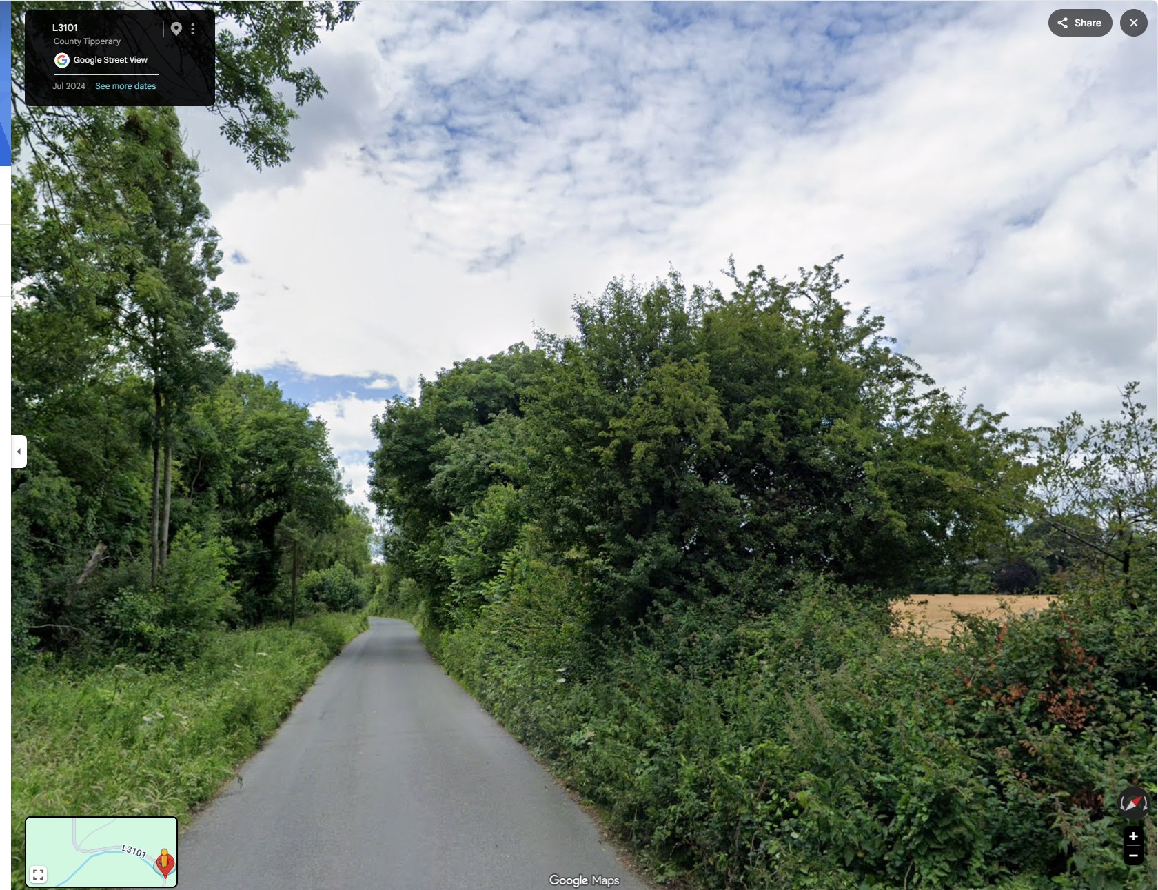
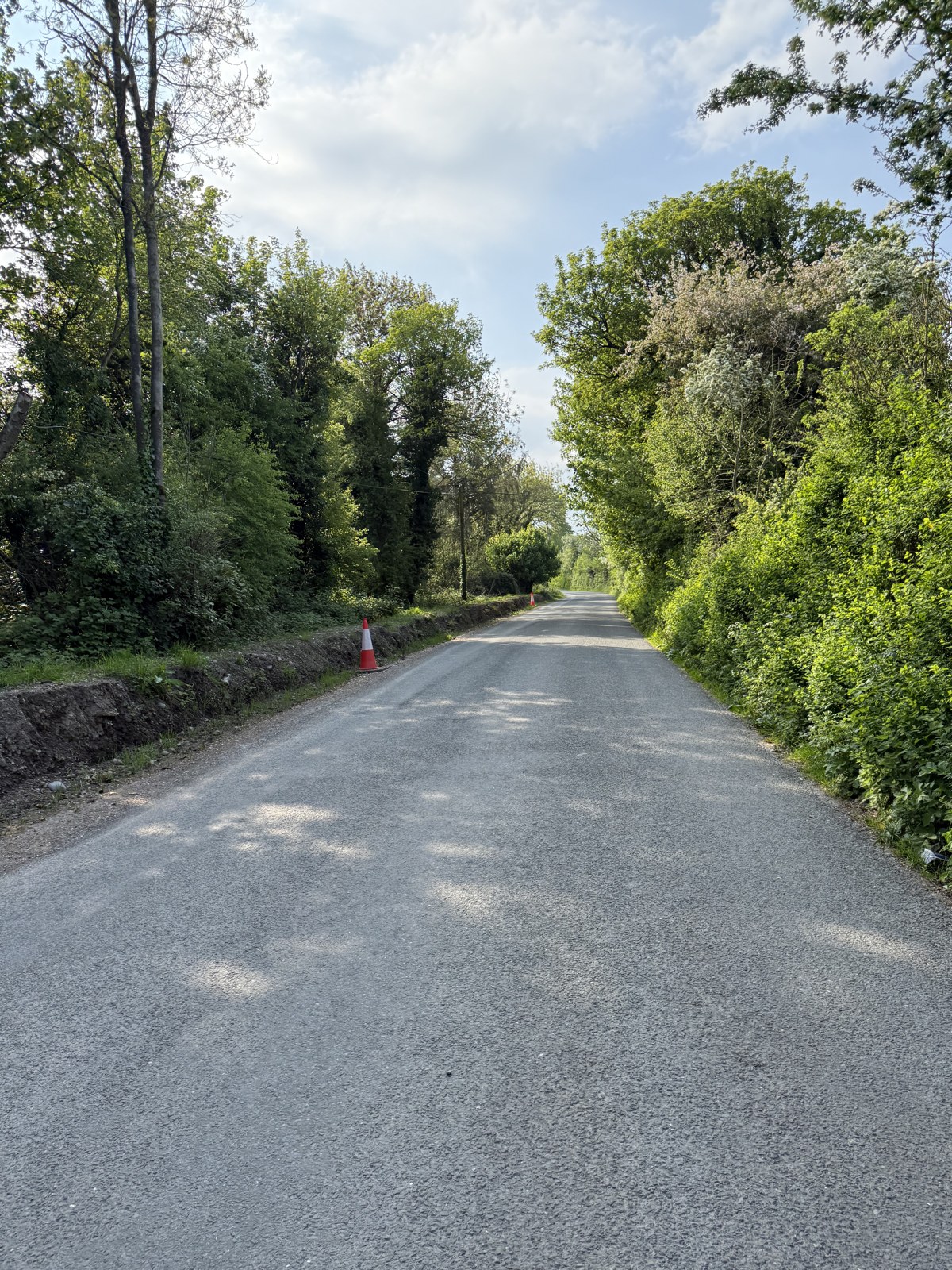
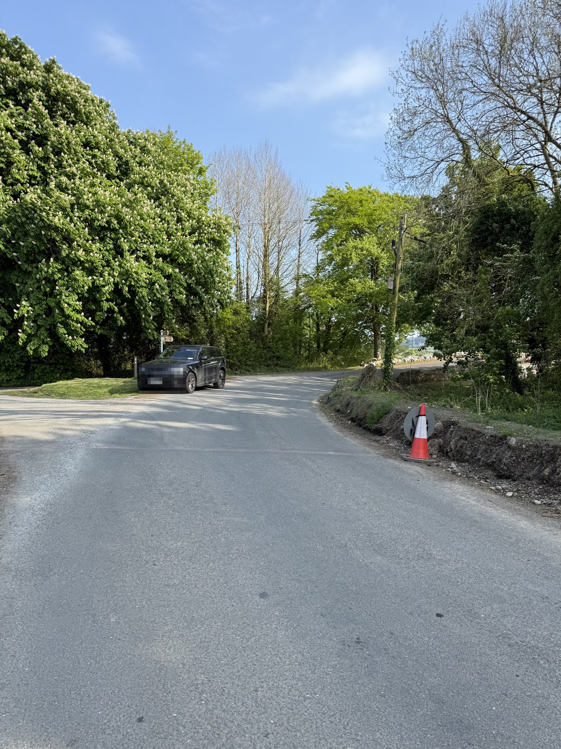
The council said there were no works here. Its own records — and these photographs — do not agree.
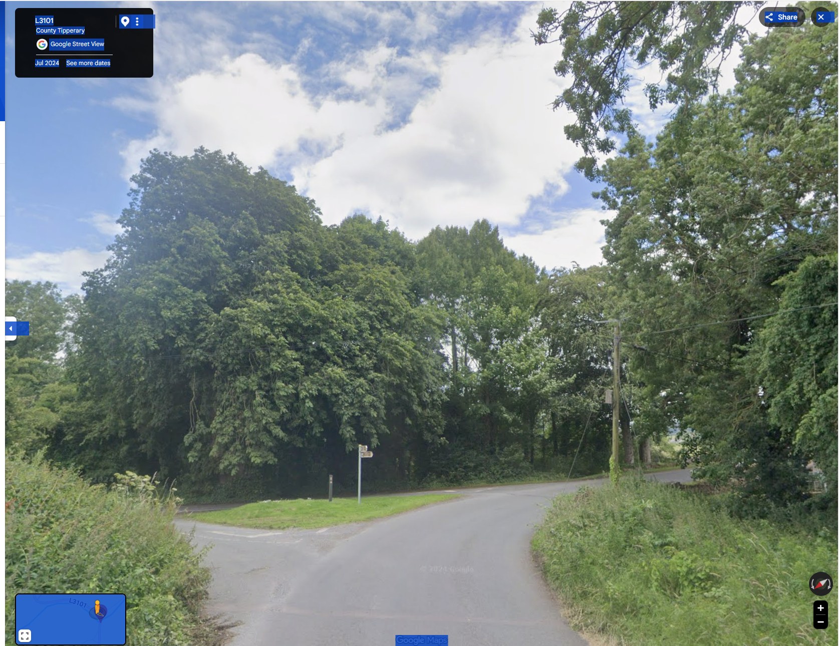
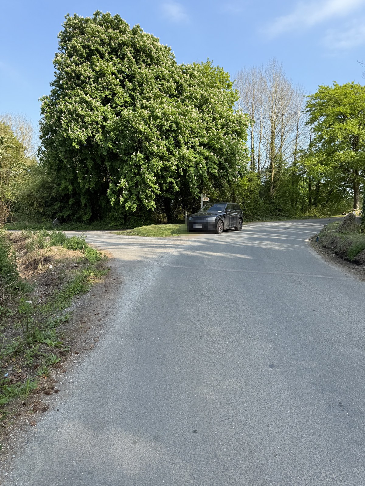
The approach to the bridge in dated records of the same place: Google Street View from July 2024, and the family’s own photographs from 1 May 2025 (the road closed for the Garda forensic examination). Three matched views — each Google capture beside the family’s photograph of the same spot.
The junction
The approach lane
The turn just before the bridge
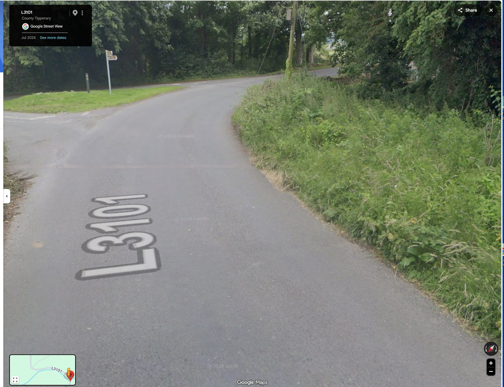
What the council was asked — and exactly what it said. Under Freedom of Information, the family’s solicitors asked Tipperary County Council for, among other records, “all documents arising out of drainage works carried out or commissioned at or on Killardry Bridge and/or the L3101 approach road to Killardry Bridge, Kilmoyler … from 2000 to date” (FOI request 106/25; internal review FOI 174/25, Roads Ref FOI 02/26).
In its Internal Review Decision of 18 February 2026, the council answered, in its own words: “The only drainage works that were carried out on the L-3151 consisted of inlets in the roadside verges being cleaned out. … There were no specific drainage works carried out on the bridge itself.” It described the 2025 roadworks on the L-3151 as “to the northwest of the bridge location.”
Request: FOI 106/25 (decision 7 October 2025 — three documents disclosed, no works, drainage or maintenance records). Answer quoted verbatim: Decision on Internal Review, Kieran Malone, Senior Engineer, Roads & Transportation, Tipperary County Council, 18 February 2026 (FOI 174/25). Held on file — see the decision.
The family’s position is that the dated imagery and their dated, GPS-located photographs show works on the approach to the bridge that this account does not reflect. In the family’s reading of the 1 May 2025 photographs, the vegetation already regrown across the disturbed bank is some two to three weeks old — which would place the ground disturbance before 24 April 2025, the night Bronagh died. The dating and significance of these works are matters the family has put on the record and is pursuing through their solicitors.
The questions the family is asking
The council was asked, under Freedom of Information, for the records of works on this road. It answered that there were “no specific drainage works carried out on the bridge itself” and that the 2025 roadworks were “to the northwest of the bridge location.” Yet the council’s own works table records a road reconstruction (2018) and a reseal (2025) on this section; Google’s own dated imagery shows the approach change from overgrown to cut back; and the family’s dated, GPS-located photographs show a fresh clay bank and disturbed ground on the approach.
The family cannot reconcile the council’s account with these records, and is left asking:
- Why does the council’s Freedom of Information answer not match its own works records and the dated photographs of this road?
- What works were carried out on this road and its approach — and when?
- Why do those works not appear in the file the family was given?
These are the family’s honestly-held questions, based on the documents and dated images set out above. They are put to Tipperary County Council, and the family is pursuing them through their solicitors.
Family photographs, 1 May 2025 (EXIF-dated 1 May 2025), GPS about 60 m from the bridge; owner’s vehicle, number plate obscured. The two-to-three-week estimate is the family’s reading of the regrowth, offered as their honestly-held opinion and subject to expert confirmation. Google Street View imagery of the L3101 approach, July 2024. Council quotation verbatim: Internal Review Decision, 18 February 2026 — see the decision.
The law and the standards — made simple
The council inspects under the Department of Transport’s Bridge Asset Management System for Regional and Local Roads (2019). In plain terms, here is what the rules required, what was recorded at Killardry, and what should have followed.
A collapsed parapet is the council’s most serious rating: RED.
“part or all… missing, collapsed or significantly displaced” = “significant damage that represents a safety hazard.”
At Killardry: the council’s own engineer recorded a five-metre length of parapet collapsed and the capping “partly removed” (21 January 2025).
What should have followed: under the manual’s “Dangerous Bridges” procedure the Municipal District Engineer checks the structure in person and, if it is an immediate risk, arranges “signing and guarding.”
The overall “repair soon” rating is not the test for a collapsed wall.
CR3 = “repair soon”; CR5 = “road closure or TMP.” The parapet is judged separately, and urgently.
At Killardry: the overall bridge rating was CR3 — but a collapsed parapet is a RED safety item in its own right.
What should have followed: the collapsed parapet triggered the urgent duty regardless of the overall ‘repair next year’ timeline.
A wall on a bridge exists to hold a vehicle on the road.
modern containment for a road structure is about 1.25 metres.
At Killardry: at the point Bronagh’s car left the road the wall stood at about 0.23 metres — roughly nine inches — with the verge grown up against it.
What should have followed: a wall at height, or a vehicle restraint, would have stood between the car and a drop of about 4.3 metres to the River Aherlow. There was none.
A blind bend and a bridge must be signed.
advance warning and chevron boards are the standard response to a constrained bend and a narrow bridge.
At Killardry: there was no advance warning sign and no chevrons on the approach; the limit was 60 km/h, cut from 80 on 7 February 2025.
What should have followed: warning signage on the approach — which, the family notes, the council installed only after Bronagh died.
The money — and the county’s road-safety record
This did not happen in a county with a quiet road-safety record. In 2023, Tipperary recorded the highest number of road deaths of any county in Ireland — 16 in the year (a count, not a per-head rate). Road Safety Authority, “Road Deaths in 2023 Increase by 19%” (1 January 2024), county table — Tipperary 16, the most of any county.
In 2025 Tipperary County Council had €4,792,990 in road and bridge funding across its programmes. None of it reached Killardry Bridge. The council’s district holds 477 bridges; the family’s question is why a bridge its own engineer had rated “Significant Damage” was not among those repaired.
In the sixteen months between that news — Tipperary reported as the county with the most road deaths in Ireland (January 2024) — and Bronagh’s death (April 2025), the Cahir–Cashel district councillors raised road safety many times: dangerous junctions, speeding, school-zone speed and pedestrian crossings all appear as formal motions in the adopted minutes. In none of the meeting records available for that period, however, was Killardry Bridge, Kilmoyler, or the L3101 approach ever raised as a dangerous location — even though the council’s own engineer had, in January 2025, rated that bridge “Significant Damage.” On those same records, the county’s record road-death toll was never analysed at district level.
Tipperary–Cahir–Cashel Municipal District adopted minutes, January 2024 to February 2025 (the meeting records published by the council). Several meetings in that window, including March and April 2025, are not in the published record; this reflects what the available minutes show.
The 60 km/h limit on that road was itself only newly in force. Ireland cut the default limit on rural local roads from 80 to 60 km/h, a change that commenced on 7 February 2025. Tipperary County Council had opposed that reduction. At its meeting of 14 October 2024 — nine months after the county had been reported as having the most road deaths in Ireland — the council unanimously agreed a motion (Ref. 2861) that the new default limits “not be universal across this County, but apply only in areas deemed necessary by this Council.” The motion was proposed by Cllr Niall Dennehy and seconded by Cllr Máirín McGrath. Most local authorities implemented the reduction; Tipperary was among the few to formally move against it. The reduction took effect regardless — and it is the 60 km/h limit that was in place when Bronagh died. At Killardry, the family’s forensic engineers put the maximum safe speed for that bend in the wet at 46 km/h — below even the new limit.
National default speed-limit change commenced 7 February 2025 (Tipperary County Council roads notice). The motion opposing the reduction (Notice of Motion Ref. 2861, proposed by Cllr Niall Dennehy, seconded by Cllr Máirín McGrath, agreed unanimously) is recorded verbatim in the adopted Minutes of Proceedings of Tipperary County Council’s monthly meeting of 14 October 2024 (held on file); also reported by Tipp FM (15 October 2024) and the Midland Tribune / Offaly Express (“National speed limit reduction divides Tipperary Council”). It was carried at full County Council, not the Cahir–Cashel district specifically.
The council’s stated approach was to apply the new limits where it judged them necessary. Yet at Killardry — where its own engineer had, on 21 January 2025, recorded a five-metre collapsed parapet and, in the record’s own words, “Is Signage Present? No” — nothing was added in the ninety-three days before Bronagh died: no sign, no barrier, no closure. The family’s question is a plain one: if the council did not act on a bridge it already knew had a collapsed wall and no signage, how could a discretion to decide where signs and limits “were necessary” have been expected to protect this road?
The funding record → · What was asked for at Kilmoyler → · How other councils treat a damaged bridge wall →
Everything that transpired
The whole sequence, from the repair that was priced and never done to the council’s account long after:
- 2014A parapet repair is priced at €450 and scheduled — and never carried out.
- 2016The scheduled inspection does not happen — “Sufficient funding was not available.”
- 2014–2024Ten years pass with no inspection on the record.
- 20 June 2024A maintenance inspection rates the bridge “Warning.”
- 21 January 2025An engineering inspection rates it “Significant Damage”: 5 m of parapet collapsed, capping “partly removed,” “Is Signage Present? No.” The council pays €19,518.50 for it.
- 7 February 2025The speed limit on the approach is cut from 80 to 60 km/h.
- 24 April 2025, 22:01In the dark and heavy rain, Bronagh’s car leaves the road at the collapsed section and enters the River Aherlow. She was within the limit and did not swerve.
- After 24 April 2025Warning signs, chevrons and road markings are installed at the bridge.
- 1 May 2025The family photograph fresh works on the approach — a clay bank and cut verge — dated and GPS-located at the bridge.
- 18 February 2026The council’s FOI internal review states there were “no specific drainage works carried out on the bridge itself.”
The questions the family is asking
From the documents and dated images set out above, the family cannot reconcile what the council recorded, what it did, and what it later said. They ask:
- Why was a bridge the council’s own engineer rated “Significant Damage,” with a collapsed parapet and no signage, left open and unmarked for 93 days?
- Why was the €450 parapet repair priced in 2014 never carried out?
- Why does the council’s Freedom of Information answer not match its own works records and the dated photographs of this road?
- What works were carried out on this road and its approach — and when?
- The family’s dated photographs appear to show a drainage and flood-prevention arrangement already in place on the approach — drains set into the road opposite the bank. On what date, and on whose authorisation, were those works carried out? Were they authorised by the District Engineer before they began?
- In October 2024 the council unanimously moved that the new 60 km/h default should apply “only in areas deemed necessary by this Council,” not universally. The family’s forensic engineers put the safe speed for the Killardry bend in the wet at about 46 km/h — below even the new 60 limit — and the bend carried no warning or advisory sign of any kind. Was a bend this dangerous not exactly the kind of place a reduced limit, and a warning, were necessary?
- Why were warning signs installed only after Bronagh died?
These are the family’s honestly-held questions, based on the record. They are put to Tipperary County Council, and the family is pursuing them through their solicitors.
Sources
Every point on this page is drawn from documents held on file and quoted verbatim:
2014 Eirspan inspection · 2024 & 2025 inspections · FOI 10526 decision · Road-management works table · Internal review decision (18 Feb 2026) · Council management report (May 2025) · Full document library
This page reproduces Tipperary County Council’s own reports, minutes and FOI decisions, and the family’s own dated photographs. It makes no allegation of wrongdoing against any named individual and determines no legal liability; those are matters for the proper legal process, which the family is pursuing through their solicitors. Views described as the family’s are their honestly-held opinion.
Last updated 2026-09-07. This is a living record — findings are added as dated entries and prior versions remain visible.