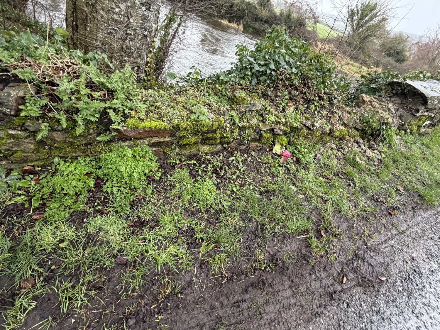
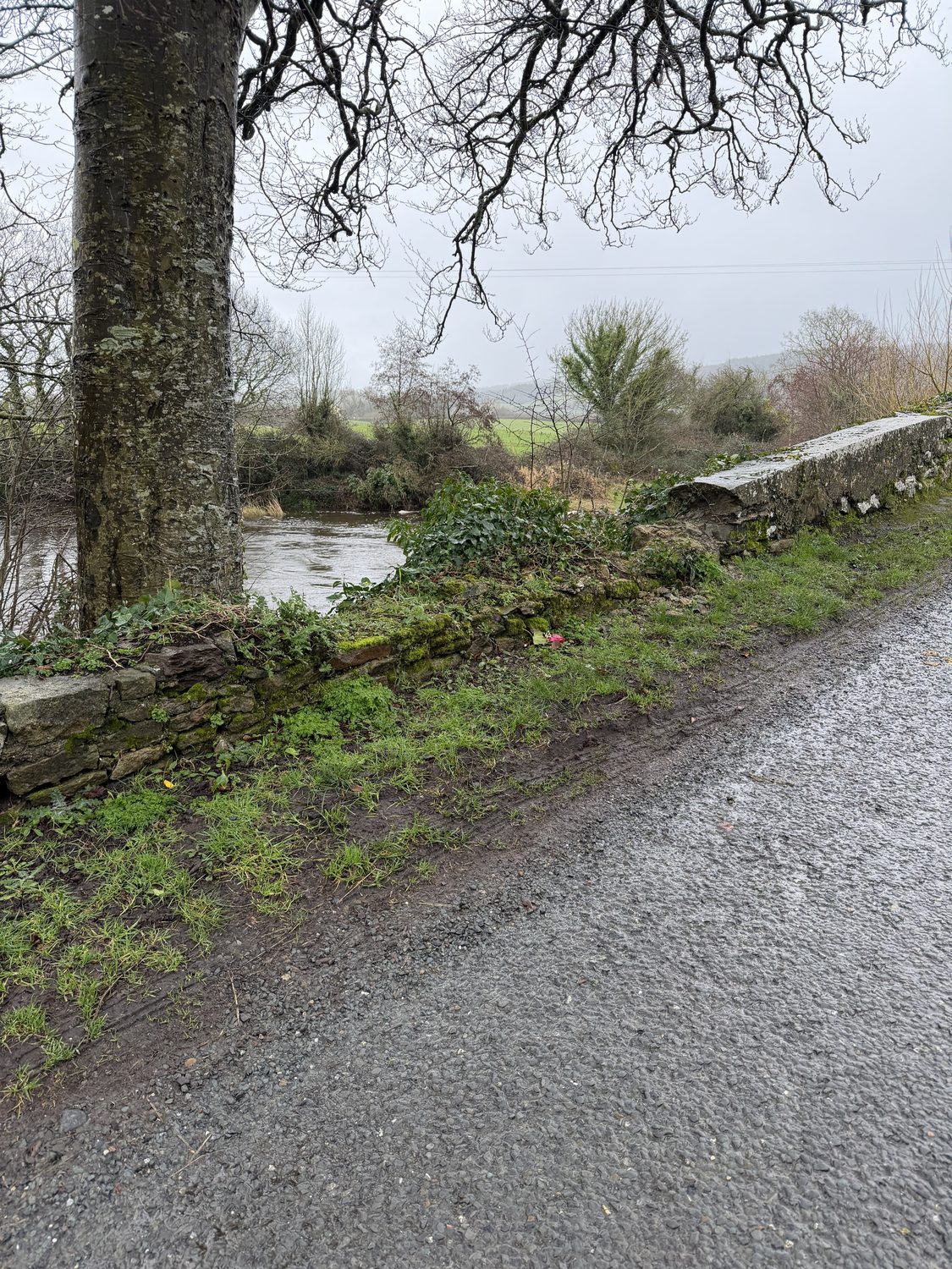
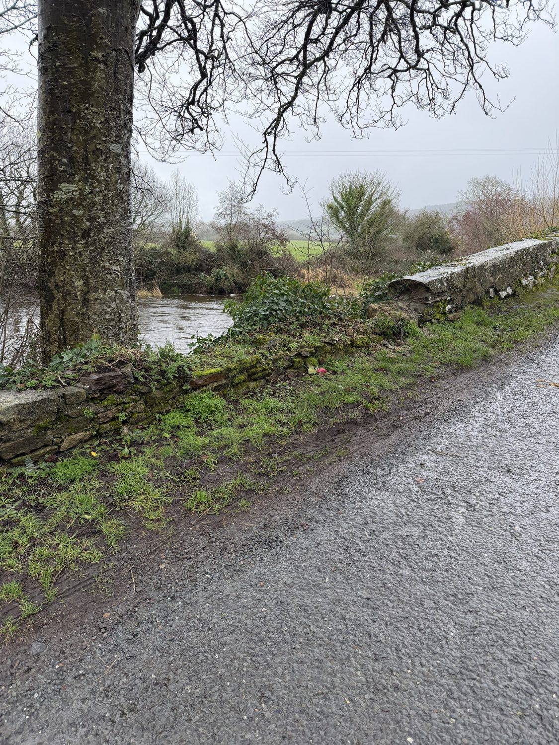
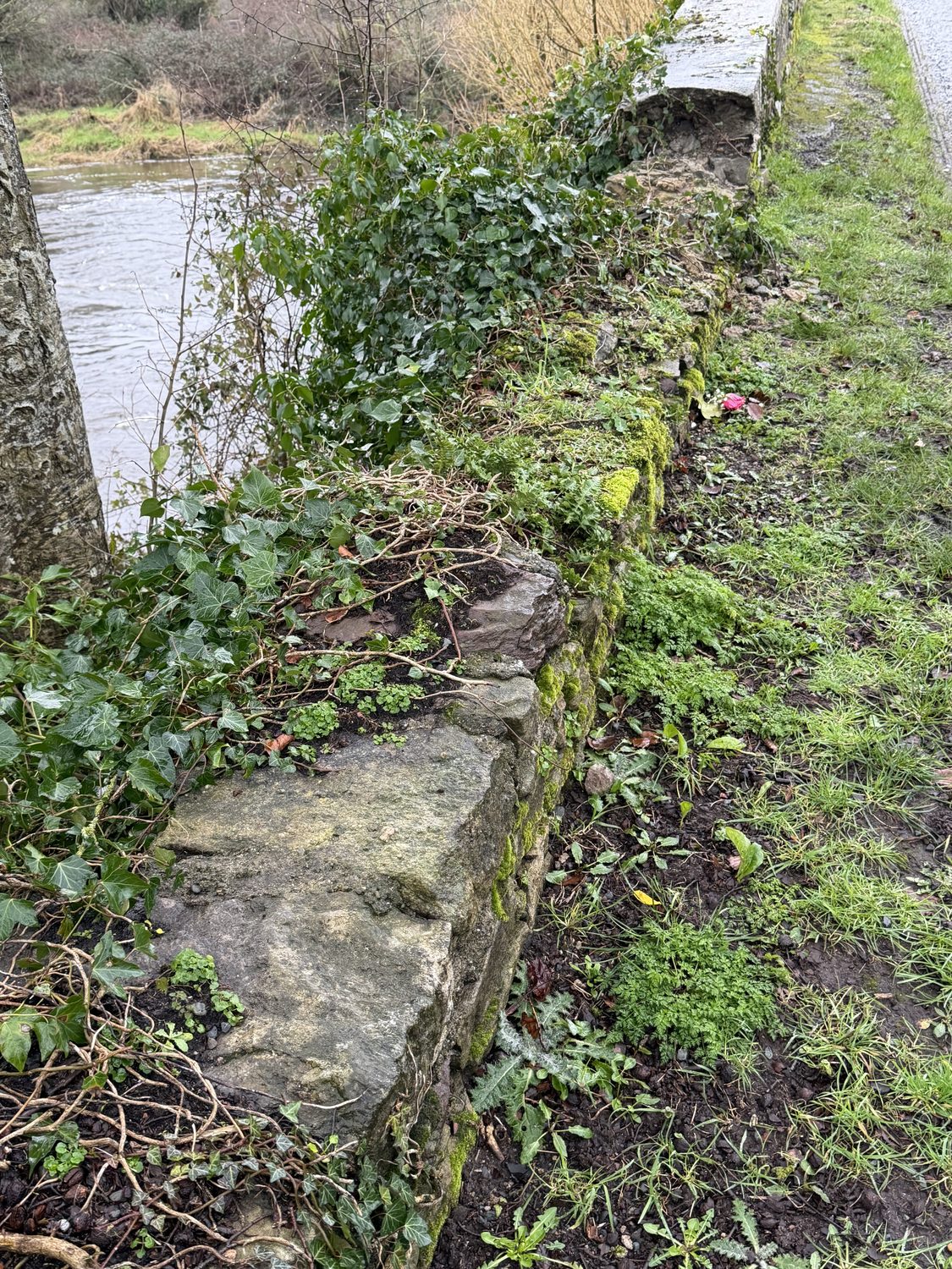
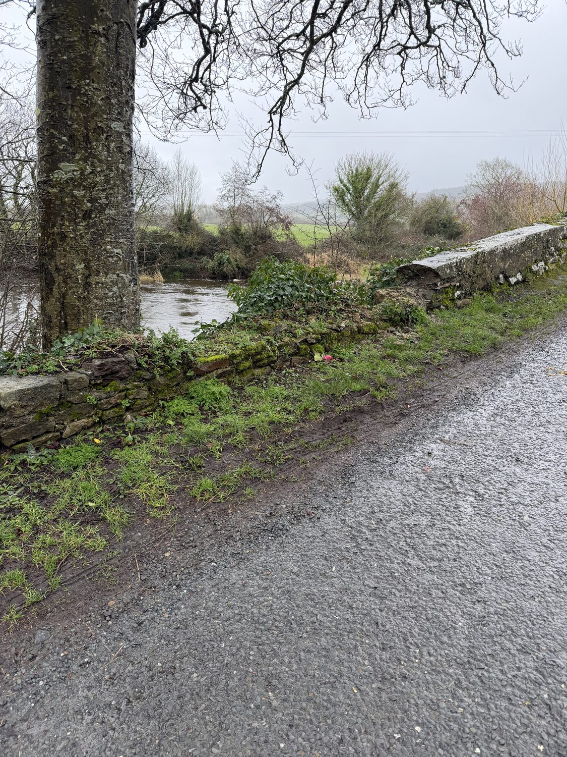
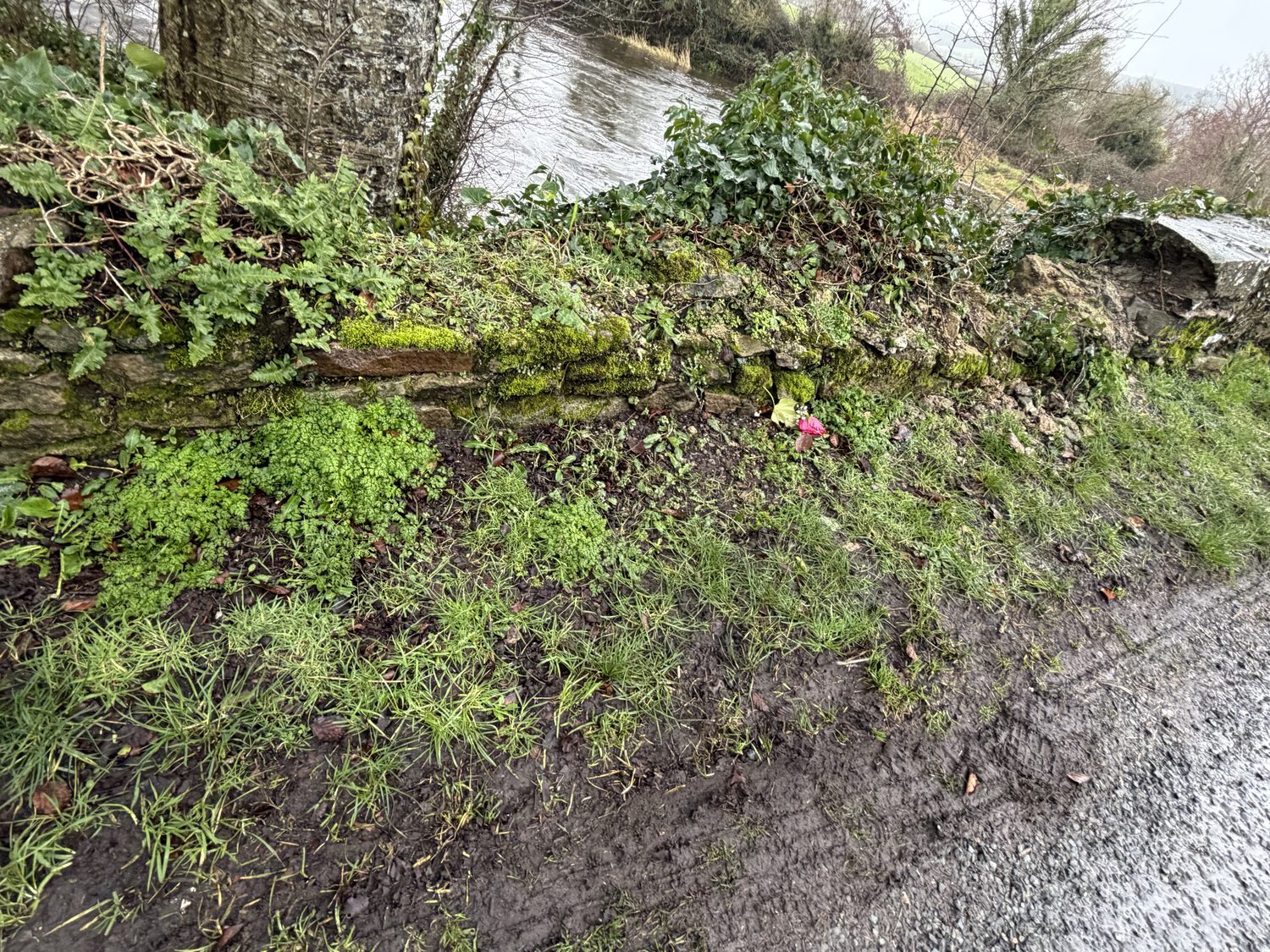
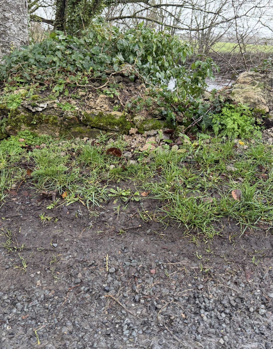
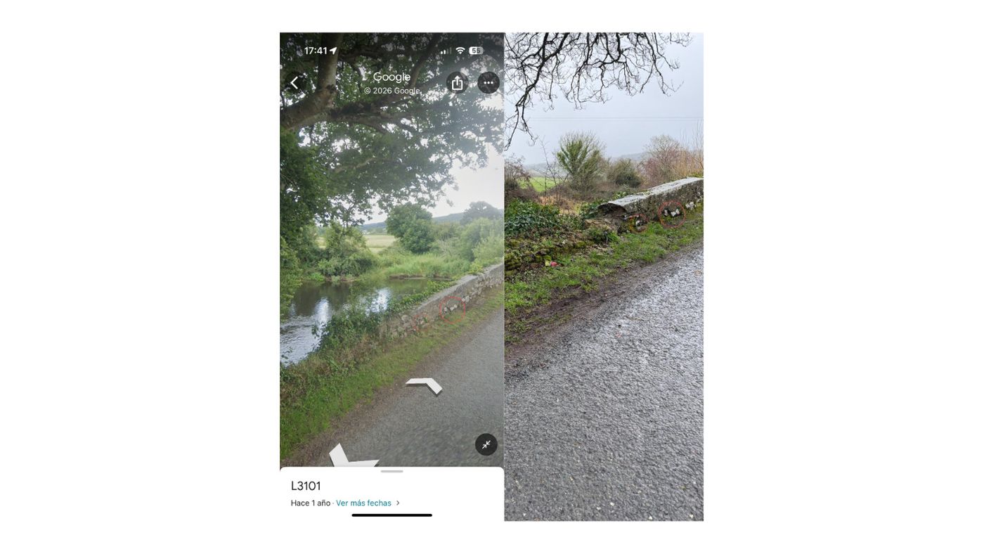
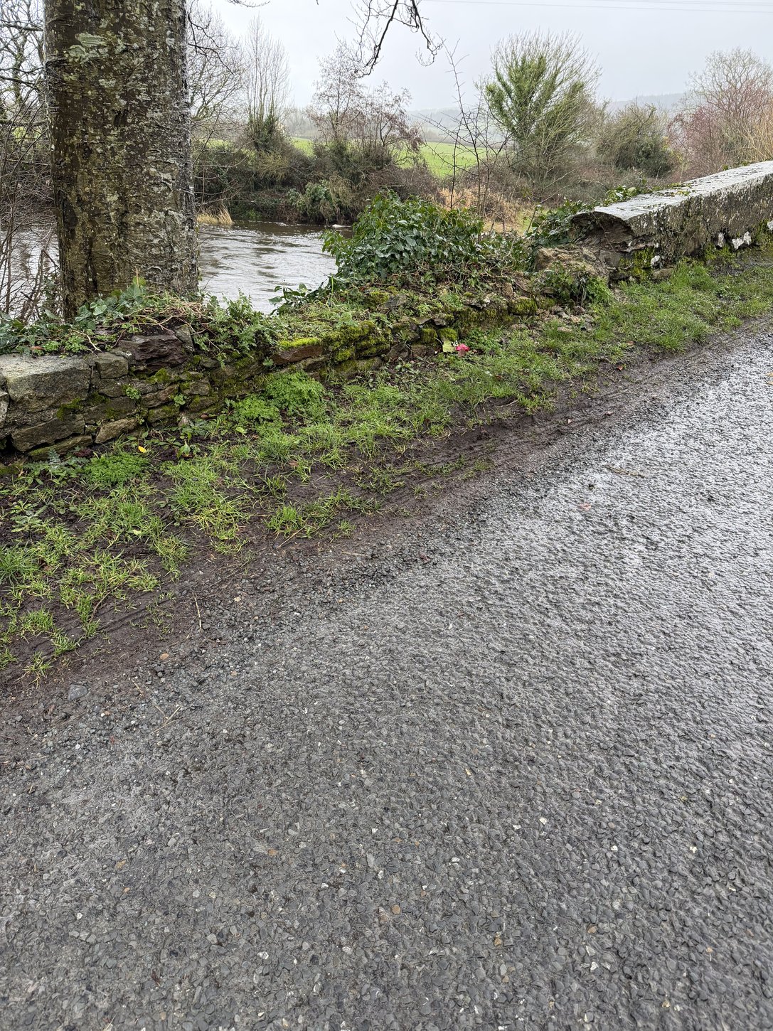
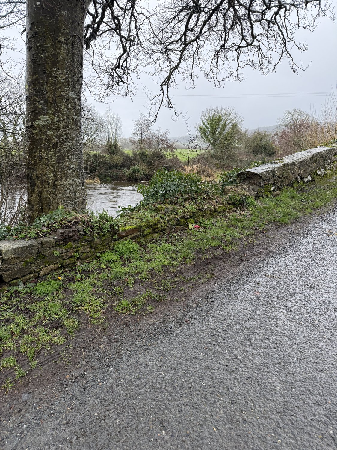
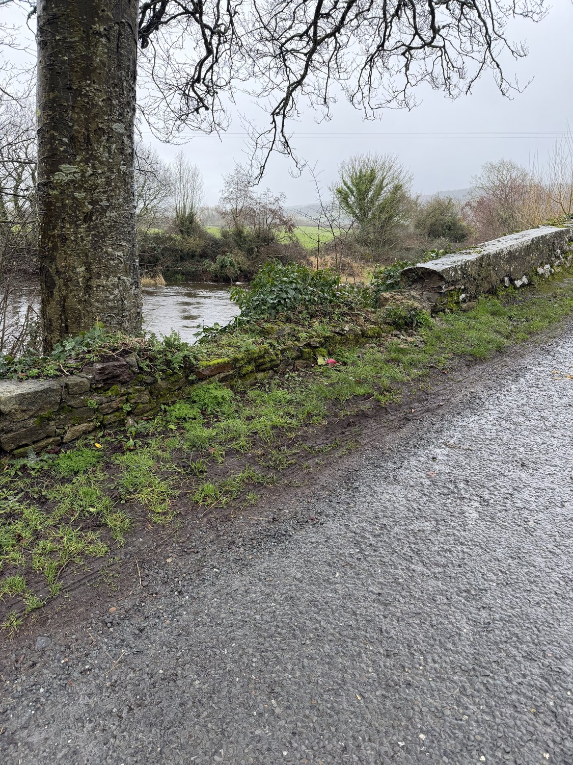
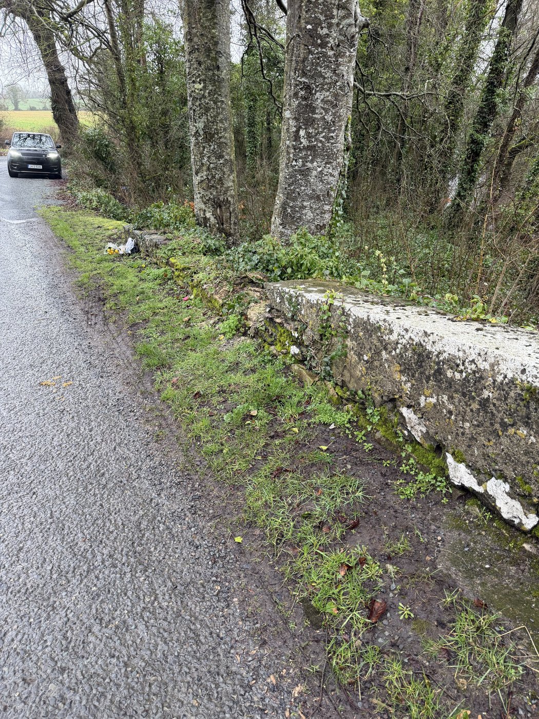
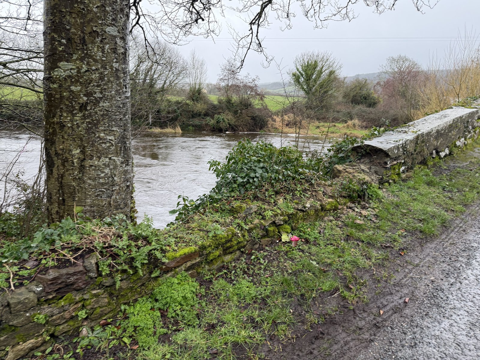
The wall Bronagh’s car went over — where the capping was removed
The parapet is the wall meant to keep a vehicle on the bridge. These are the family’s own
photographs of the exact place the car left the road: the capping removed and never put back, and the grass
verge grown up against the wall so it stood barely above the road.
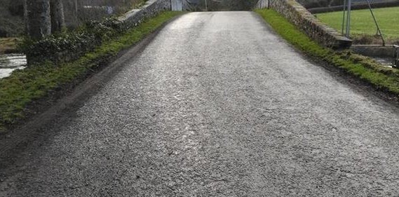
The parapet at the point on the bridge the car reached — the capping removed, and no bend-warning sign or reduced speed on the approach. The council's own inspection of 21 January 2025 recorded the capping “partly removed.”Photograph: family, 2026The point where the collapsed section of wall meets the intact, capped section. A vehicle leaving the road here meets no barrier before the River Aherlow.Photograph: family, 2026The drop to the River Aherlow at the collapsed section — measured at about 4.3 metres to the water by the forensic engineer. The capping stone is gone and was not replaced.Photograph: family, 2026The parapet reduced to rubble, a displaced stone at its base and the capping gone — the river directly beyond.Photograph: family, 2026The capping removed — as recorded in the council's engineering inspection of 21 January 2025 — the wall standing barely above the road, the river beyond.Photograph: family, 2026The collapsed parapet along the road, its capping gone; the council's inspection recorded it “partly removed.” A rose lies at the spot.Photograph: family, 2026The height of the wall at the point the car left the road — the capping gone and the grass verge grown almost to the top of the remaining stonework.Photograph: family, 2026Where the capping was removed and never put back — the wall that should have stopped the car reaching the water.Family photograph with Google Street View, 2026The five-metre stretch where the wall's capping was removed — recorded in the council's inspection of 21 January 2025.Family photograph, February 2026The grass verge grown level with the lowered wall at the crossing point.Family photograph, February 2026The grass verge grown level with the lowered wall at the crossing point.Family photograph, February 2026A surviving section of the wall, its capping still in place, near the roadside.Family photograph, February 2026The collapsed section beside the River Aherlow.Family photograph, February 2026Over the crest of the humpback bridge — the lowered, grassed-over wall on the left.Family photograph, February 2026
Aerial footage of the bridge — the drop, and the wall that is not there. From the family's interview with The Nationalist / Tipperary Live, October 2025; used with permission. The full report →
Family photographs, 2026. The removal of the capping is recorded in Tipperary County Council’s
own engineering inspection of 21 January 2025 (rated “Significant Damage”, ref TY-L3151-B-010, which states
that “the capping of the downstream wall has been partly removed”). Presented so the public can see the
wall’s condition. This does not determine legal liability.
Last updated 2026-09-07. This is a living record — findings are added as dated entries and prior versions remain visible.